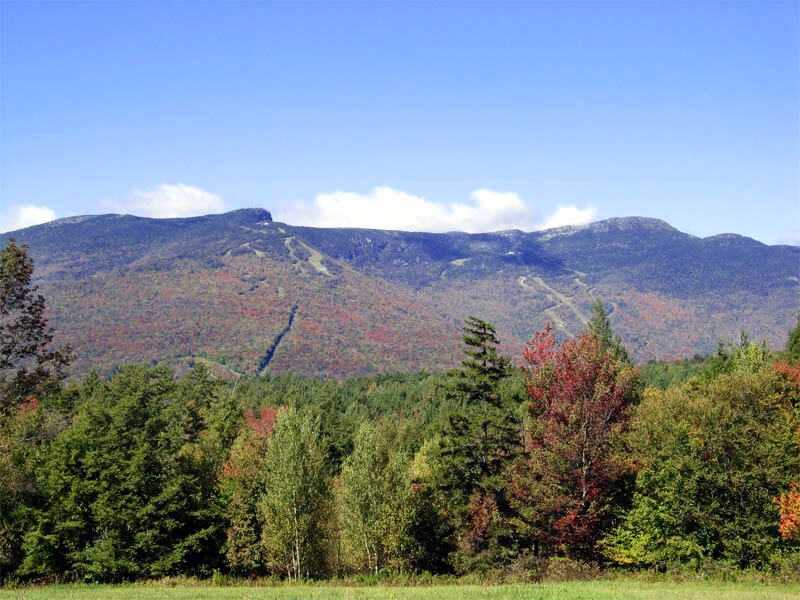
Mount Mansfield
Vermont

Last Updated 31 Jan 2026
Mount Mansfield, Vermont's highest peak, is a prominent feature in Chittenden County. Its unique summit ridge resembles a human face, with distinct parts named accordingly: Adams Apple (4,060 feet), Chin (4,393 feet, the highest point), Nose (4,062 feet), and Forehead (3,940 feet). The Long Trail, spanning approximately 2.3 miles from Adams Apple to Forehead, is one of two places in Vermont where Arctic Tundra exists. Mount Mansfield is a popular destination, attracting nearly 40,000 visitors annually, so it's crucial to stick to the trail to protect the fragile vegetation.
The mountain's weather can drastically differ from the surrounding lower areas. In winter, the summit often experiences blowing snow and clouds. Above the tree line, whiteouts are common, posing risks of disorientation. Visibility can drop to a mere 20 feet, making it easy to lose one's way. In such conditions, choosing less exposed routes, like the Laura Cowles Trail, is safer than the more open Sunset Ridge.
Access Point
Navigate to G5HM+5J Stowe, Vermont.
To reach the Long Trail (LT) and Haselton Trail trailheads, head north on VT 100 to Stowe, then take VT 108. The Haselton Trail begins at the Gondola Base Lodge parking lot, and the LT trailhead is 0.6 miles to the north.
For the Sunset Ridge Trail, start at Underhill State Park. From Underhill Center, follow Pleasant Valley Road for about a mile north, then take Mountain Road to the state park (parking fees apply). From the park, follow the old CCC road for a mile to where the trail diverges left off the road.
Recommended Route
Follow the Nose-to-Chin Long Trail.
Mount Mansfield offers several popular routes. Underhill State Park is a common starting point from the west, featuring trails like Sunset Ridge and Laura Cowles. From the east, the Long Trail is the most popular. The most straightforward ascent is via the Toll Road.
Regulations
The State of Vermont closes Mount Mansfield's trails from mid-April to Memorial Day to protect the vegetation and trails from erosion. The Green Mountain Club advises against high-elevation hiking during this period.
No fees or permits are required, except if using the toll road or gondola.
Camping & Lodging
Given the mountain's manageable size, most visitors complete the climb in a day. For overnight stays, the Green Mountain Club's Taft Lodge is available. The lodge charges $6 per person. Visitors should bring their own stove and toilet paper, as fires are prohibited and the outhouse might lack supplies. Although water is available, it's from an untested source, so bringing a water filter is advisable.
FAQs
Is Mount Mansfield suitable for beginners?
Mount Mansfield offers a variety of trails, some of which are suitable for beginners. However, due to its rapidly changing weather conditions, even the easier trails require caution.
Do I need a permit to hike Mount Mansfield?
No special hiking permit is required. However, there may be fees if you're using certain facilities like the toll road or gondola.
What is the best time of year to hike Mount Mansfield?
The best time to hike is typically from late spring to early fall. The State of Vermont closes the trails from mid-April to Memorial Day to protect the environment, making early spring and late fall less ideal.
How long does it typically take to hike Mount Mansfield?
The time to hike Mount Mansfield varies based on the trail and individual pace, but most day hikes can take anywhere from a few hours to a full day.
Are there any unique features of Mount Mansfield?
Yes, the summit ridge of Mount Mansfield resembles a human face, with distinct features named Adams Apple, Chin, Nose, and Forehead. It also contains one of the two Arctic Tundra environments in Vermont.
Can I camp on Mount Mansfield?
Overnight camping is available at the Green Mountain Club's Taft Lodge. Reservations and fees may apply, and visitors should bring essential supplies.
What are the weather conditions like on Mount Mansfield?
Weather on Mount Mansfield can be unpredictable and change rapidly. Winters are especially harsh, with frequent whiteouts and blowing snow above the tree line.
Is there any wildlife to be aware of on Mount Mansfield?
The area is home to various wildlife, including black bears. Hikers should take precautions with food storage and be aware of their surroundings.
