Mount Rogers
Virginia

Last Updated 31 Jan 2026
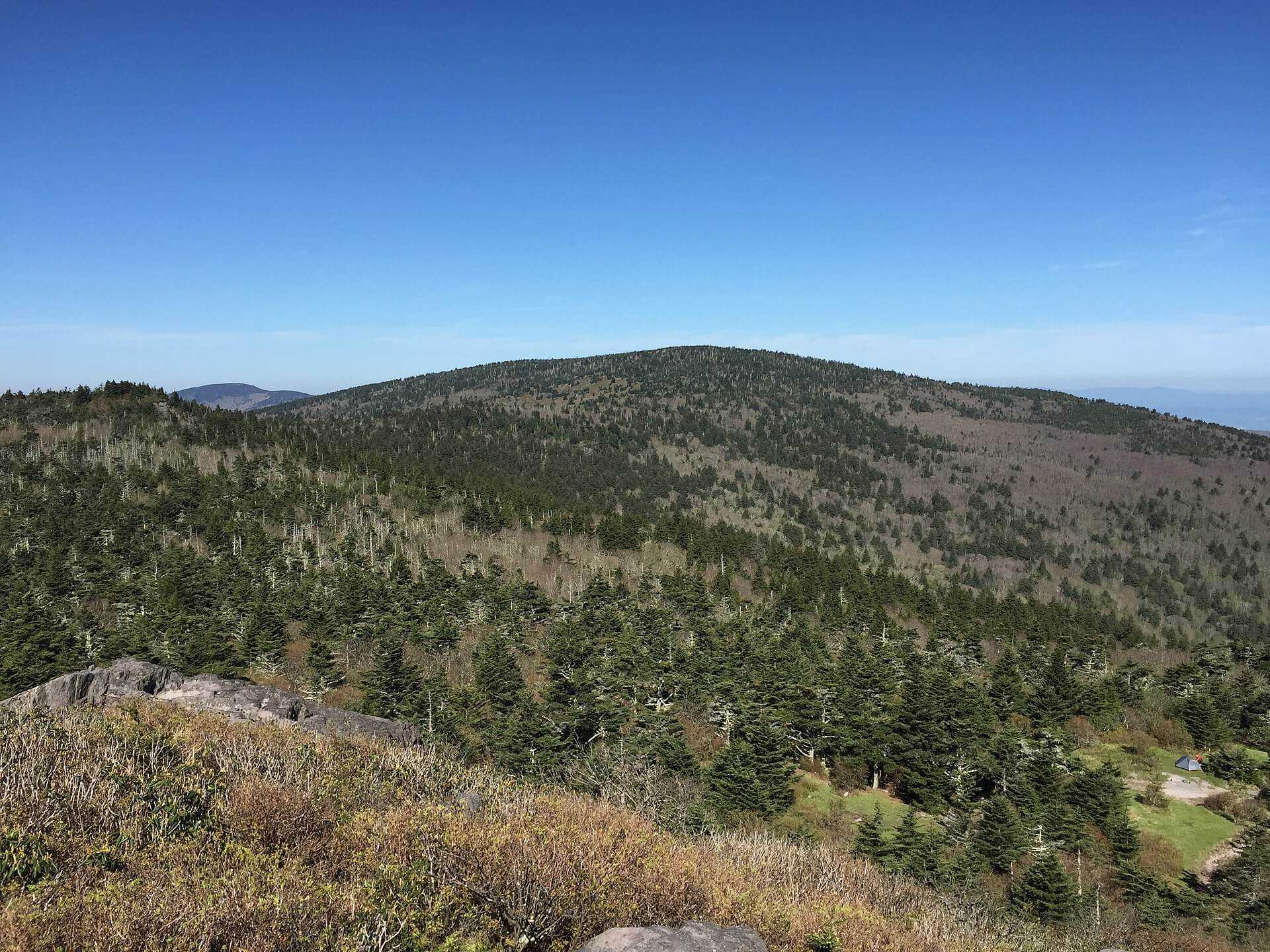
Mount Rogers is the highest peak in Virginia, the second-most prominent and second-most isolated peak in the state, the 19th-highest state highpoint, and the fourth-highest east of the Mississippi River. Interestingly, it is the highest eastern state highpoint without any roads or pavement leading to its summit, making it a true hiker's destination.
Due to its popularity, Grayson Highlands State Park was established near Mount Rogers in 1965. The following year, the United States Congress created the Mount Rogers National Recreational Area (NRA) to protect the region's natural landscape. The Mount Rogers summit is the centerpiece of the NRA, the highest point in the Lewis Fork Wilderness, and the George Washington-Jefferson National Forest. The mountain is also the highest point of the New River and Kanawha River drainage basins, with the nearest higher peak being Grandfather Mountain, over 40 miles away in North Carolina.
Mount Rogers is home to one of the few remaining high-altitude Southern Appalachian spruce-fir forests, featuring Fraser firs, a rare evergreen tree found only above 5,500 feet in a few locations in the Appalachian Mountains. Unfortunately, these forests have been declining due to the balsam woolly adelgid, an invasive insect that first infested the area in 1962.
Visitors to Mount Rogers from Grayson Highlands State Park (Massie Gap) will likely encounter wild ponies, a significant attraction in the area. These Shetland ponies were introduced to manage the spread of native hawthorn and thrive above 4500' elevation. The population, managed by the Wilburn Ridge Pony Association, is kept around 120 through an annual adoption auction at Grayson Highland Fall Fest. The ponies, frequently seen between Massie Gap and Thomas Knob Shelter, are comfortable around humans, though touching and feeding them is prohibited by park policy.
Access Point
Navigate to JFMR+8G Mouth of Wilson, Virginia.
The primary access points for the Mount Rogers hike are from Grayson Highlands State Park. The Massie Gap parking area is the most popular starting point. From here, hikers can access the Appalachian Trail, which leads to the Mount Rogers Spur Trail. Parking is plentiful, though it can fill up quickly during peak seasons, so arriving early is wise.
- From Interstate 81: Near Marion, take exit 45 and turn south onto State Highway 16.
- State Highway 16: Follow this for approximately 24.1 miles, then turn right onto U.S. Highway 58.
- U.S. Highway 58: Continue for approximately 7.7 miles, then turn right onto State Highway 362.
- State Highway 362: Drive nearly two miles to reach the parking area for Massie Gap in Grayson Highlands State Park.
Recommended Route
Follow the Rhododendron Trail to Appalachian Trail. Note that the AllTrails route below follows the Appalachian Trail only. You can save about 1.5 miles by taking the Rhododendron Trail for the first half-mile of the hike.
The most common route to Mount Rogers is a 9-mile round trip starting from the Massie Gap parking area in Grayson Highlands State Park. The trail begins with a gentle ascent through open meadows and hardwood forests before reaching the Appalachian Trail. Follow the white blazes of the AT southbound, passing through picturesque highlands and rocky outcrops until you reach the blue-blazed Mount Rogers Spur Trail. The summit is densely wooded with no views, but the journey offers plenty of scenic rewards, including the chance to see the wild ponies.
- Massie Gap (Elevation 4,650'): Start here and follow the Rhododendron Trail north for half a mile.
- Appalachian Trail (AT): Turn left and follow the AT up Wilburn Ridge through Rhododendron Gap.
- Thomas Knob Shelter: Continue past this shelter to the short spur trail leading to the Mount Rogers summit.
- Mount Rogers Summit: The total distance is approximately four miles one way. This route is the most popular and highly recommended for reaching the summit.
Regulations
- Permits: No permits are required for day hiking.
- Camping: Backcountry camping is allowed in designated areas. Be sure to practice Leave No Trace principles.
- Wildlife: Do not feed or approach the wild ponies. Bear encounters are possible, so use bear-proof containers and follow safety guidelines.
- Dogs: Allowed but must be kept on a leash.
- Leave No Trace: Pack out all trash and respect the natural environment.
- Grayson Highlands State Park Fees:
- Peak season weekend day: $3 per vehicle.
- Peak season weekday: $2 per vehicle.
- Memorial Day-Labor Day: $2 per vehicle.
- Park Hours: Typically open from 7:00 AM to 10:00 PM during spring, summer, and autumn. Open from sunrise to sunset in winter.
Lodging & Camping
Grayson Highlands State Park offers several options for lodging and camping:
- Campgrounds: The park has multiple campgrounds with amenities like restrooms, showers, and picnic tables.
- Backcountry Camping: Designated backcountry sites along the Appalachian Trail, such as the Thomas Knob Shelter, provide scenic spots for overnight stays.
- Nearby Lodging: For those preferring more comfort, nearby towns like Abingdon offer various lodging options, such as hotels, bed and breakfasts, and vacation rentals.
FAQs
How long does it take to hike to the summit of Mount Rogers?
Most hikers complete the round trip to Mount Rogers summit in about 4 to 6 hours, depending on pace and conditions.
Are there any water sources along the trail?
Yes, there are several reliable water sources along the Appalachian Trail, but they must have a water filter to ensure safe drinking.
Can you see wild ponies year-round?
Yes, the wild ponies in Grayson Highlands can be seen year-round. However, they are more active and visible during the warmer months.
Is the trail to Mount Rogers suitable for beginners?
The hike to Mount Rogers is moderately challenging due to its length and elevation gain. Those new to hiking should prepare adequately and consider their fitness levels.
