Mount Davis
Pennsylvania

Last Updated 31 Jan 2026
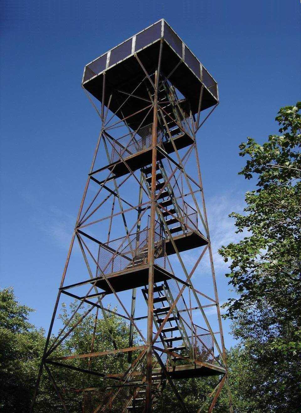
Mount Davis is the highest point in Pennsylvania. Located in Somerset County within the Forbes State Forest, it offers hikers beautiful trails, a rich history, and panoramic views from its observation tower.
Mount Davis is named after John Nelson Davis, a prominent figure in the area fascinated by its flora and fauna. The mountain is part of the 30-mile-long Negro Mountain range, a name that has sparked historical debates and attempts at renaming. The area around Mount Davis has a storied past, with the mountain itself playing a part in local lore and early American frontier history.
Access Point
Navigate to QRVM+PF Meyersdale, Pennsylvania.
To reach Mount Davis, drive to the town of Salisbury, PA. From there, follow Route 219 north and then Route 669 west to reach Mount Davis Road. The main parking area for the High Point Trail is well-marked and provides easy access to the trailhead.
Recommended Route
Follow the Mount Davis Highpoint Trail.
The most popular route to the summit is the High Point Trail, a two-mile round-trip hike, which is well-maintained and marked with yellow blazes. The path, built by the Civilian Conservation Corps in the 1930s, leads through a serene forest and culminates at the summit, where you can climb the observation tower for expansive views of the surrounding area. Consider the 5.7-mile Mount Davis Highpoint Trail loop for a longer hike, which offers additional scenic points and a moderate challenge.
Regulations
There are no fees or permits required to hike to Mount Davis. The trails are open year-round, but winter conditions can make access challenging due to snow and ice. Before your visit, check current trail conditions with the Forbes State Forest office. Camping in the forest is allowed but restricted to designated backpacking sites. A permit is required for stays longer than one night.
Lodging & Camping
While no camping facilities are directly on Mount Davis, nearby Forbes State Forest offers several backpacking sites. Additionally, there are various lodging options in the surrounding area, including bed and breakfasts and lodges in towns like Salisbury and Meyersdale. Forbes State Forest provides a rustic experience with beautiful natural surroundings for those looking to camp.
Campers should follow these guidelines:
- Set up camp at least 100 feet away from any stream.
- Maintain a distance of at least 200 feet from roads and keep campsites out of sight.
- Ensure campsites are at least 25 feet away from and not visible from any trails.
- Position field toilets at least 200 feet from any water source.
- Pack out all trash and waste.
- Avoid having campfires during periods of high wildfire risk.
FAQs
Is the hike suitable for beginners?
Yes, the High Point Trail is suitable for beginners. It is relatively short and well-marked, making it accessible for hikers of all skill levels. The longer loop trail is still manageable for most hikers.
When is the best time to hike Mount Davis?
The best times to hike Mount Davis are in the spring and fall when temperatures are mild, and the foliage is most vibrant. Summer hikes are enjoyable but can be hot, while winter hikes offer a peaceful, snowy landscape but may require additional preparation for icy conditions.
