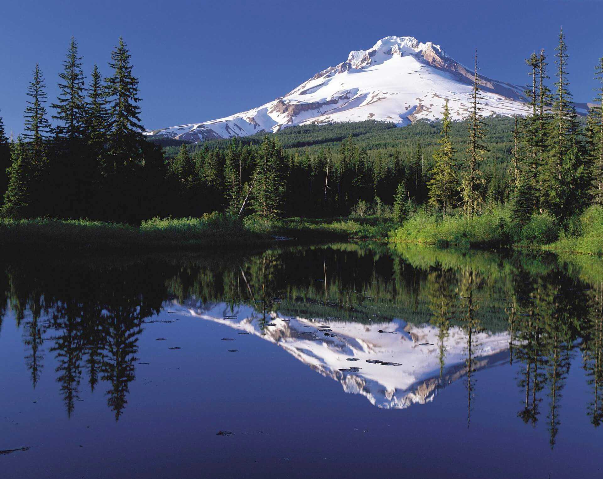
Mount Hood
Oregon

Last Updated 31 Jan 2026
Mount Hood, located about 50 miles east of Portland, Oregon, is one of North America's most climbed glaciated peaks and is considered the second most popular behind Japan's Fuji-san. This dormant volcano, last erupting in 1907, still has active fumaroles. Its relatively low altitude, straightforward approach, and short hiking/climbing distances make it accessible to less experienced climbers. However, this has led to a higher rate of accidents due to severe weather and inexperience. Skiers can descend directly from the summit, and dogs often make the ascent.
Mount Hood has been a revered site for indigenous tribes for centuries. Its rich history is reflected in the mountain's natural and cultural landscapes. The Timberline Lodge, constructed in 1937 as a Works Progress Administration project, is a significant historical and architectural landmark. Notably, the lodge was used for the exterior shots of the Overlook Hotel in Stanley Kubrick's 1980 film, The Shining. This cinematic history has added to the lodge's allure, attracting film enthusiasts and outdoor adventurers.
With its striking silhouette and volatile weather, the mountain has been a beacon for climbers and hikers. The variety of ecosystems, from dense forests at lower elevations to alpine meadows and glaciers near the summit, makes Mount Hood a microcosm of the Pacific Northwest's natural beauty.
Access Point
Navigate to 87JR+69 Government Camp, Oregon.
The most common access point is the Timberline Lodge, accessible via US Highway 26 towards Government Camp. The lodge, located at an elevation of 5,800 feet, offers amenities such as year-round skiing, snowboarding, and dining options. Other trailheads include Cloud Cap Saddle Campground, Top Spur Trailhead, and Ramona Falls, each providing unique access to different mountain parts.
Recommended Route
Take the South Side Route.
South Side Route (Hogsback / Pearly Gates)
The South Side Route is the most popular and shortest route to the summit, starting from the Timberline Lodge. The climb begins on a dedicated climbers' trail along the east side of the ski area, passing landmarks such as the Silcox Hut at 7,000 feet. The route continues to the top of the Palmer ski lift at 8,600 feet, a crucial waypoint where many climbers take a break and assess conditions.
From the top of the Palmer lift, the path leads towards Crater Rock, navigating between the Devil's Kitchen fumaroles, known for their sulfuric emissions, and Steel Cliff. The next key landmark is the Hogsback, a snow ridge leading to the Bergschrund, a large crevasse often requiring careful crossing. Climbers ascend through the Pearly Gates, a narrow and frequently icy chute between rock towers, before reaching the summit.
Key Landmarks
- Silcox Hut: A historic structure serving as a waypoint.
- Palmer Glacier: A popular stopping point and the last major break before the final ascent.
- Crater Rock: A prominent feature marking the entry into the more technical portions of the climb.
- Devil's Kitchen: Notable for its fumaroles emitting gases that can create oxygen-depleted zones.
- Hogsback: A crucial ridge that serves as a path to the summit's upper reaches.
- Bergschrund: A significant crevasse that can pose challenges depending on snow conditions.
- Pearly Gates: The final steep ascent through a narrow chute to the summit.
An early start, often around midnight, is critical for a safe ascent. This "Alpine start" helps climbers avoid rockfall, which becomes more prevalent as temperatures rise throughout the day. It ensures that they descend before the afternoon when weather conditions deteriorate rapidly.
Regulations
Starting January 1, 2024, a permit is required to climb above 9,500 feet. Permits can be purchased online at Recreation.gov. Additionally, climbers are encouraged to fill out a climbers' registration form, available at the Timberline Climbers' Cave. Please use "blue bags" for waste disposal. Mountain Locator Units (MLUs) are available for rental to assist in emergencies.
Lodging & Camping
Camping options include:
- Palmer Glacier: Near exposed rocks above the lift, below Crater Rock.
- Timberline Lodge Parking Lot: Sleeping in vehicles is allowed.
- National Forest Area: Below the lodge, accessible via the first left after the Timberline access road from US-26.
Camping on the summit is permitted but uncommon. There are no fees or registration requirements for these camping options.
FAQs
What is the best time to climb Mount Hood?
The best time to climb is typically from May to early July for snow and ice conditions. For hiking and general exploration, July to September offers more stable weather.
Do I need a permit to climb Mount Hood?
Yes, a climbing permit is required year-round for ascents above 9,500 feet. These can be purchased online, with no limit on the number of permits issued.
What equipment do I need for the climb?
Essential gear includes an ice axe, crampons, and a helmet. Depending on conditions, ice tools may also be necessary. Be prepared for cold and variable weather.
Can I ski from the summit?
Yes, experienced skiers often descend directly from the summit. However, this requires advanced skiing skills and appropriate equipment.
What are the dangers of the fumaroles?
The fumaroles emit gases that can create oxygen-depleted zones, posing a risk of asphyxiation. It is advisable to avoid lingering in these areas.
What is the significance of an Alpine start?
An Alpine start, typically around midnight, is crucial to avoid rockfall and to ensure descent before weather conditions worsen in the afternoon.
Is there cell phone service on the mountain?
Cell phone service is limited and unreliable, so carry a Mountain Locator Unit (MLU) for emergencies.
Can I camp on the summit?
Camping on the summit is permitted but not popular due to harsh conditions and limited space.
What should I do in case of an emergency?
In case of an emergency, call 911. Carrying a Mountain Locator Unit (MLU) or ensuring someone knows your itinerary and expected return time is advisable.
