Black Mesa
Oklahoma

Last Updated 31 Jan 2026
Oklahoma's highest point sits in the northwest corner of the Panhandle atop Black Mesa, named for the dark pumice found all over the terrain, a remnant of volcanic activity from 30 million years ago. The mesa straddles the borders of Oklahoma, Colorado, and New Mexico, making it a tri-state landmark. Historically, Native American tribes inhabited the area, and later, it became a strategic military location. Today, Black Mesa is a protected nature preserve known for its unique blend of Rocky Mountain and shortgrass prairie ecosystems.
Lava flows from the nearby Capulin Volcano in New Mexico formed Black Mesa. These igneous rocks are much more durable and erosion-resistant than the sedimentary rocks they overlay, creating a protective cap that has preserved the mesa over millions of years. The actual summit of Black Mesa lies in Colorado, with the USGS listing its highest point at 5,715 feet. The highest point of Mesa de Maya, also known as the Corona, is 6,840+ feet in Las Animas County, Colorado
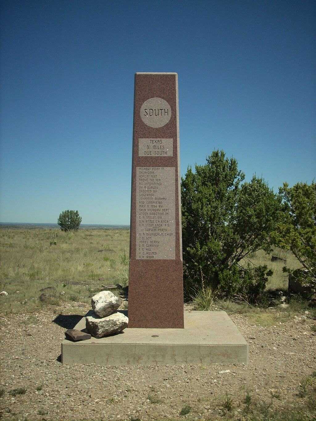
The tall granite column on Oklahoma's highest point explains that Cimarron County is the only county in the U.S. to touch four states (Texas, New Mexico, Colorado, and Kansas). It also shows the distance from the highpoint to each state boundary.
Access Point
Navigate to X24V+W7 Kenton, Oklahoma.
To reach Black Mesa, drive to Kenton, Oklahoma. From there, head east on CR 325 for 0.5 miles, then turn north and continue for 5.0 miles until you reach the Nature Conservancy preserve parking lot on the left. The trailhead parking lot provides ample space and a vault toilet but no water facilities. It's advisable to stock up on supplies in Kenton before starting your hike.
Recommended Route
Follow the Black Mesa Trail.
The Black Mesa Trail is an 8.5-mile round-trip hike. The first 2.5 miles are relatively flat, following an old roadbed along the mesa's base. The trail then ascends 600 feet via switchbacks over the next mile, offering impressive views of the surrounding landscape. After reaching the top, it's another mile to the summit marker, a granite obelisk marking the highest point in Oklahoma. The trail is well-marked, with mileage signs and benches for rest stops.
Regulations
Hiking at Black Mesa is permitted year-round from dawn to dusk. There is no fee to access the trail, and no permits are required. Camping is allowed only in designated areas within Black Mesa State Park but not along the trail. The Nature Conservancy owns the route to Oklahoma's highpoint, which has purchased much of the land in the area and is maintaining its natural beauty for future generations.
Lodging & Camping
Black Mesa State Park offers camping facilities with restrooms, showers, and picnic areas for those looking to extend their visit. Additionally, several bed and breakfasts and lodges in Kenton and the surrounding area provide comfortable accommodations.
FAQs
What should I bring for the hike?
Bring plenty of water, sun protection (hat, sunscreen), a wind-resistant jacket, and snacks. No water sources are along the trail, so pack enough for the entire hike.
Is the hike suitable for beginners?
While the hike is mostly flat, the ascent up the mesa can be moderately challenging. The round trip distance of 8.5 miles may also be strenuous for beginners, so be sure to prepare accordingly.
When is the best time to hike Black Mesa?
The trail is open year-round, but spring and fall are the best times to hike due to milder temperatures. Summer can be scorching with little shade, and winter can be windy and cold.
