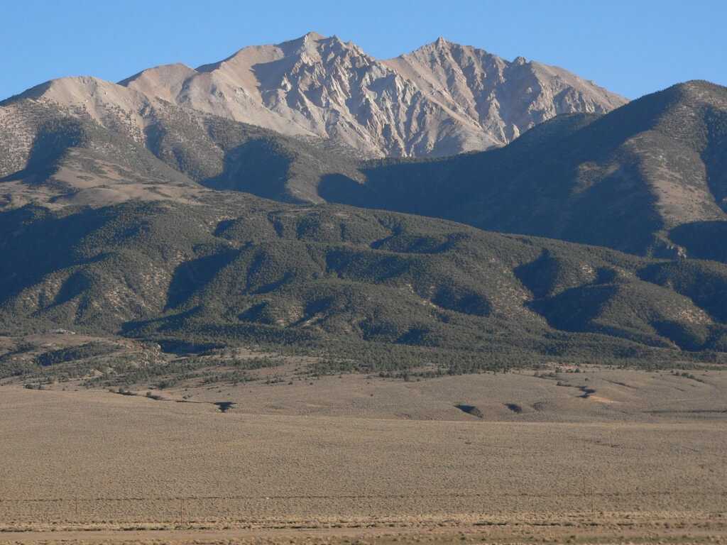
Boundary Peak
Nevada

Last Updated 31 Jan 2026
Boundary Peak, at 13,147 feet, is the highest point in Nevada and offers an exhilarating adventure for hikers. Situated at the northern end of the White Mountains, this peak is part of a twin summit with Montgomery Peak in California, which stands 298 feet higher. A rugged ridge separates the peaks by about two-thirds of a mile. Despite its modest prominence of just over 250 feet, Boundary Peak provides hikers with stunning vistas and a challenging climb.
Boundary Peak derives its name from its proximity to the Nevada-California state line, which runs through the saddle between Boundary and Montgomery Peaks, and the two states did not resolve the boundary dispute until they were legally settled in 1980. The controversy originated from a survey conducted in 1873 by Alexey Von Schmidt, whose inaccurate boundary line placed Boundary Peak in California. Later surveys corrected this error, placing Boundary Peak within Nevada. If surveyors had not adjusted the boundary, Wheeler Peak in Great Basin National Park would hold the title of Nevada's highest point.
Access Point
Navigate to VM9V+MF Dyer, Nevada.
To reach the primary access point for Boundary Peak, you need to get to Nevada Highway 264. Approximately 200 yards south of Nevada Highway 264 and Nevada Highway 773 junction is a rough dirt road heading west. While a 4-wheel drive vehicle is not required, a high-clearance vehicle is recommended, especially for the final mile. The road includes a few small streams and washes to cross. Follow this road for about 14.7 miles to the trailhead, noting several waypoints along the way:
- At 2 miles: Continue straight at a crossroads.
- At 2.4 miles: Continue straight again.
- At 11 miles: Turn right at the B & B Mine, then quickly left. (Turning left leads to a parking area; two rights lead to the mine buildings.)
- At 12.1 miles: Follow the signed road up the canyon to the right.
- At about 13 miles: Pass a small reservoir and continue on the rough road to the trailhead.
An alternative route is the Queen Canyon Road off U.S. Highway 6, just east of the Nevada-California border. This road is very rough but passable up to the Queen Mine at 9,200 feet.
Recommended Route
Follow the Boundary Peak Trail.
The most recommended route to Boundary Peak is the Boundary Peak Trail, a 7.4-mile round-trip hike. The trail leads to a saddle 2,300 feet below the summit, where hikers climb strenuously through loose scree and minor scrambling near the summit.
Regulations
When hiking Boundary Peak, adhere to the following regulations:
- Permits: None are required for hiking or camping in the Boundary Peak Wilderness. A campfire permit is required if you plan to have a fire.
- Sign-In: Sign in and out at the log box located at the trailhead.
- Leave No Trace: Pack out all trash to minimize your environmental impact.
- Wildlife: Do not feed or approach wildlife. Maintain a safe distance at all times.
- Stay on the Trail: Always stay on designated trails to prevent erosion and protect vegetation.
- Fires: Open fires are prohibited unless you have a campfire permit.
Lodging & Camping
For those seeking lodging, the nearby town of Bishop, California, offers various options, including hotels, motels, and bed-and-breakfasts.
Camping options include:
- Trailhead Camping: Some hikers camp at the trailhead or along the road near the small reservoir.
- Trail Canyon: Camping is possible in Trail Canyon, although flat spots are limited.
Bring plenty of water as this is a desert region. There is a small stream with a spring in Trail Canyon, but due to cattle grazing, treat any water you collect.
FAQs
How challenging is the hike to Boundary Peak?
The hike to Boundary Peak is considered strenuous due to the significant elevation gain and rugged terrain. Hikers should be in good physical condition and prepared for high-altitude hiking.
What is the best time of year to hike Boundary Peak?
The best time to hike Boundary Peak is from late June to early October, when the trail is usually snow-free. Weather conditions can change rapidly, so always check the forecast before your hike.
Are there any guided tours available?
There are no regularly scheduled guided tours specifically for Boundary Peak, but several outdoor adventure companies in the Bishop area may offer custom-guided hikes upon request.
Is there cell phone reception on the trail?
Cell phone reception is limited and unreliable on the trail. Before setting out, it is advisable to inform someone of your hiking plans and expected return time.
