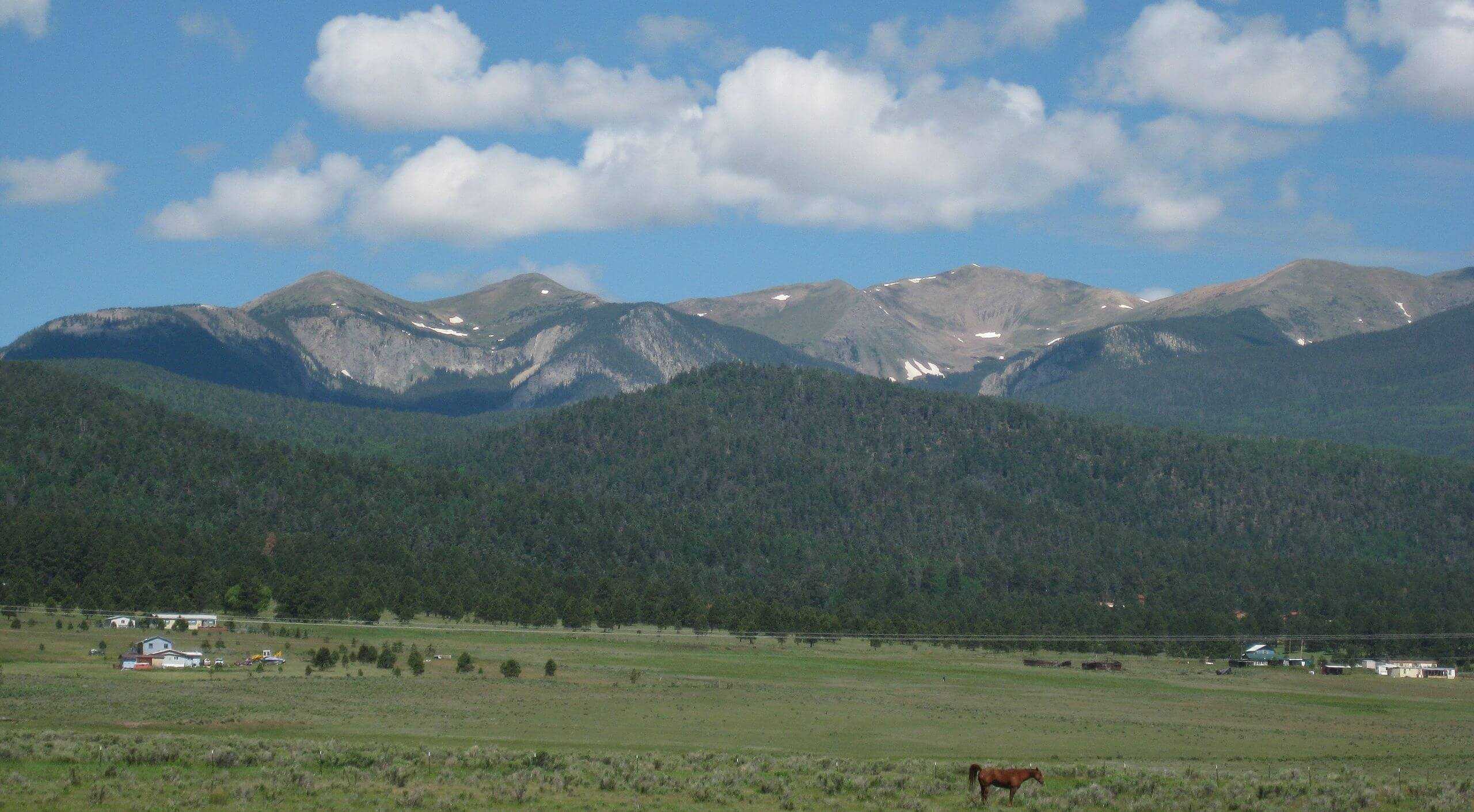
Wheeler Peak
New Mexico

Last Updated 31 Jan 2026
Nestled in the Sangre de Cristo Mountains, Wheeler Peak stands tall as the highest point in New Mexico, reaching an elevation of 13,161 feet. The Sangre de Cristo range is a spectacular collection of peaks that stretches 250 miles from Santa Fe, New Mexico to Salida, Colorado. This majestic peak offers hikers a challenging yet rewarding adventure with panoramic views, diverse wildlife, and rich cultural history. Whether you're an experienced mountaineer or a dedicated hiker, Wheeler Peak promises an unforgettable experience.
Named after George Montague Wheeler, a pioneering surveyor who led expeditions in the late 19th century, the peak is part of the Taos Ski Valley and lies within the Carson National Forest. For years, the Truchas Peaks, located south of Wheeler Peak, were considered the New Mexico highpoint. In 1948, a survey conducted by Harold D. Walker confirmed Wheeler Peak as the highest point in the state. The area is steeped in Native American history, particularly the Taos Pueblo people, who have lived in the region for centuries and regard the mountain as sacred. Big horn sheep are abundant but are wary of visitors.
Access Point
Navigate to HHF6+PG Taos Ski Valley, New Mexico.
The primary access point for hiking Wheeler Peak is the Williams Lake Trailhead near the Taos Ski Valley. To reach the trailhead, drive north from Taos on NM-150 for about 19 miles until you reach the Taos Ski Valley. Continue to follow the signs toward the Williams Lake Trailhead parking area. The road is well-maintained, but during winter, it may require a vehicle equipped for snowy conditions.
Recommended Route
Follow the Williams Lake Trail.
The most popular route to Wheeler Peak is the Williams Lake Trail, an approximately 8-mile round trip with a 3,000-foot elevation gain. Starting from the Williams Lake Trailhead, the hike initially leads you through a beautiful forest before reaching the picturesque Williams Lake. From there, the trail becomes steeper as you ascend towards the summit of Wheeler Peak. A sub-peak north of Wheeler Peak named Walker is often mistaken for Wheeler. The final stretch involves a series of switchbacks and rocky terrain, so be prepared for a strenuous climb. The breathtaking views from the summit, including the Taos Ski Valley and surrounding peaks, are well worth the effort.
Regulations
When hiking Wheeler Peak, please adhere to the following regulations to preserve the natural environment:
- Permits: No permits for day hikes or overnight camping are required.
- Leave No Trace: Pack out all trash to minimize your environmental impact.
- Wildlife: Do not feed or approach wildlife. Maintain a safe distance at all times.
- Stay on the Trail: Always stay on designated trails to prevent erosion and protect vegetation.
- Fires: No open fires above the tree line. Use a portable stove for cooking.
Lodging & Camping
Several lodging options are available in the nearby Taos Ski Valley, ranging from cozy lodges to luxurious accommodations. For those interested in camping, the Carson National Forest offers numerous campgrounds. Backcountry camping is permitted without fees or permits, but the Carson National Forest has a 14-day camping limit.
However, the first two miles of the Williams Lake Trail are on private property, so no camping is allowed at Williams Lake. The Twining Campground, located near the trailhead, is a convenient alternative.
FAQs
How strenuous is the hike to Wheeler Peak?
The hike to Wheeler Peak is considered strenuous due to its elevation gain and rocky terrain. It requires a good level of fitness and acclimatization to high altitudes.
What is the best time of year to hike Wheeler Peak?
The best time to hike Wheeler Peak is from late June to early October when the trails are generally snow-free. Weather conditions can change rapidly, so always check the forecast before your hike.
Are there any guided tours available?
Several outfitters in the Taos area offer guided hikes to Wheeler Peak. These tours can provide valuable insights into the local flora, fauna, and history and ensure a safe hiking experience.
Can I bring my dog on the trail?
Dogs are allowed on the trail but must remain leashed. Ensure your dog is well-prepared for the hike, with plenty of water and protection against the elements.
Is there cell phone reception on the trail?
Cell phone reception is limited and unreliable on the trail. Before setting out, it's advisable to inform someone of your hiking plans and expected return time.
