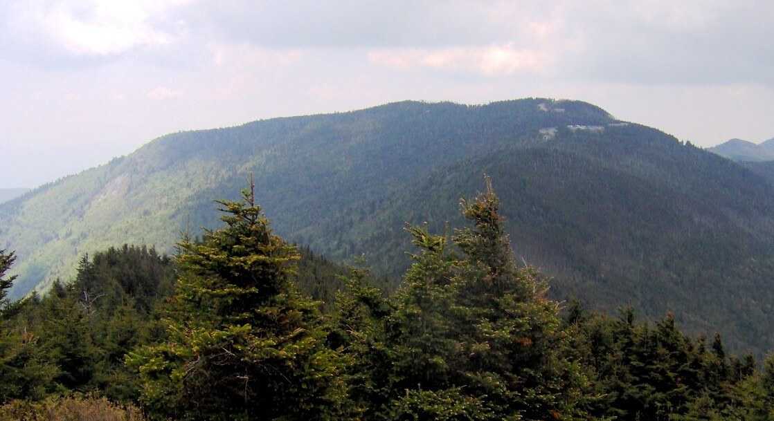
Mount Mitchell
North Carolina

Last Updated 31 Jan 2026
Mount Mitchell, located about 35 miles northeast of Asheville in North Carolina's Black Mountains, is the highest peak in the United States east of the Mississippi River, standing at 6,684 feet. It is part of the Black Mountain Crest, which includes six other peaks above 6,300 feet, such as Mount Craig, the second-highest peak in the eastern U.S. The summit lies within Mount Mitchell State Park, while many approach trails, including the Mount Mitchell Trail, begin in the Pisgah National Forest. In the summer, hikers can enjoy a variety of blooming wildflowers, and trout fishing is popular in the nearby creeks.
In the early 20th century, several companies, including Brown Brothers, Carolina Spruce, Dickey and Campbell, and Perley and Crockett, heavily logged Mount Mitchell. They stripped most trees from the slopes of the Black Mountains and transported them by railroad to Pensacola, NC, and Black Mountain, NC. John Silcox Holmes and Locke Craig played vital roles in transforming the logged areas into a state park. In 1909, officials appointed Holmes as state forester, and he reported on the forest conditions. Craig, elected governor in 1913, helped pass a bill on March 3, 1915, to create a park on Mount Mitchell, establishing one of the first state or federal parks in the Southeast U.S.
During the logging and early years of the park, visitors could access the mountain by railroad from Black Mountain, NC. In 1922, a toll road replaced the tracks, and eventually, the Blue Ridge Parkway replaced the toll road from Buck Creek Gap to Black Mountain Gap in 1939.
Access Point
Navigate to QP8M+HQ Burnsville, North Carolina.
From the South
- Take I-40 to exit 86 and connect with NC SR-226 towards Marion/Shelby.
- Turn left onto the Blue Ridge Parkway.
- At mile marker 355, turn north on NC SR-128 and drive into the park.
- Pass the Mount Mitchell State Park Office and reach the summit parking lot.
From the North
- Take US-19E to Micaville and turn south on NC SR-80.
- Turn right and head south on the Blue Ridge Parkway.
- At mile marker 355, turn north on NC SR-128 and drive into the park, following the directions above.
Recommended Route
The easiest way to reach the summit is to drive to the parking lot about 100 feet below the summit. From there, walk up the paved path to the top.
Take the Mount Mitchell Summit Trail.
Regulations
There are no significant regulations for visiting Mount Mitchell, but a permit is required for camping in Mount Mitchell State Park, and there is a fee for camping at the Black Mountain Campground.
Lodging & Camping
Mount Mitchell State Park offers year-round walk-in and primitive/backpack campsites. Rates vary between summer and winter, so check the park's website for the latest information.
A popular campground in Pisgah National Forest is the Black Mountain Campground, located at 50 Black Mountain Campground Road, Burnsville, NC 28714. This campground operates on a first-come, first-served basis and charges a fee. It is open from April 14 to November 1.
Bear-proof your campsite since black bears are prevalent in this area.
FAQs
What is the best time of year to visit Mount Mitchell?
The best time to visit Mount Mitchell is during the summer and fall. Summer offers blooming wildflowers, while fall provides stunning foliage.
Do I need a permit to hike Mount Mitchell?
No permit is needed to hike Mount Mitchell, but a permit is required for camping in Mount Mitchell State Park.
Is the trail to the summit difficult?
The trail from the parking lot to the summit is a short, paved path, making it accessible for most visitors.
Are there restroom facilities at Mount Mitchell State Park?
Yes, there are restrooms and a museum at the highpoint parking lot.
Is Mount Mitchell suitable for children and older adults?
Yes, the paved path from the parking lot to the summit suits visitors of all ages.
