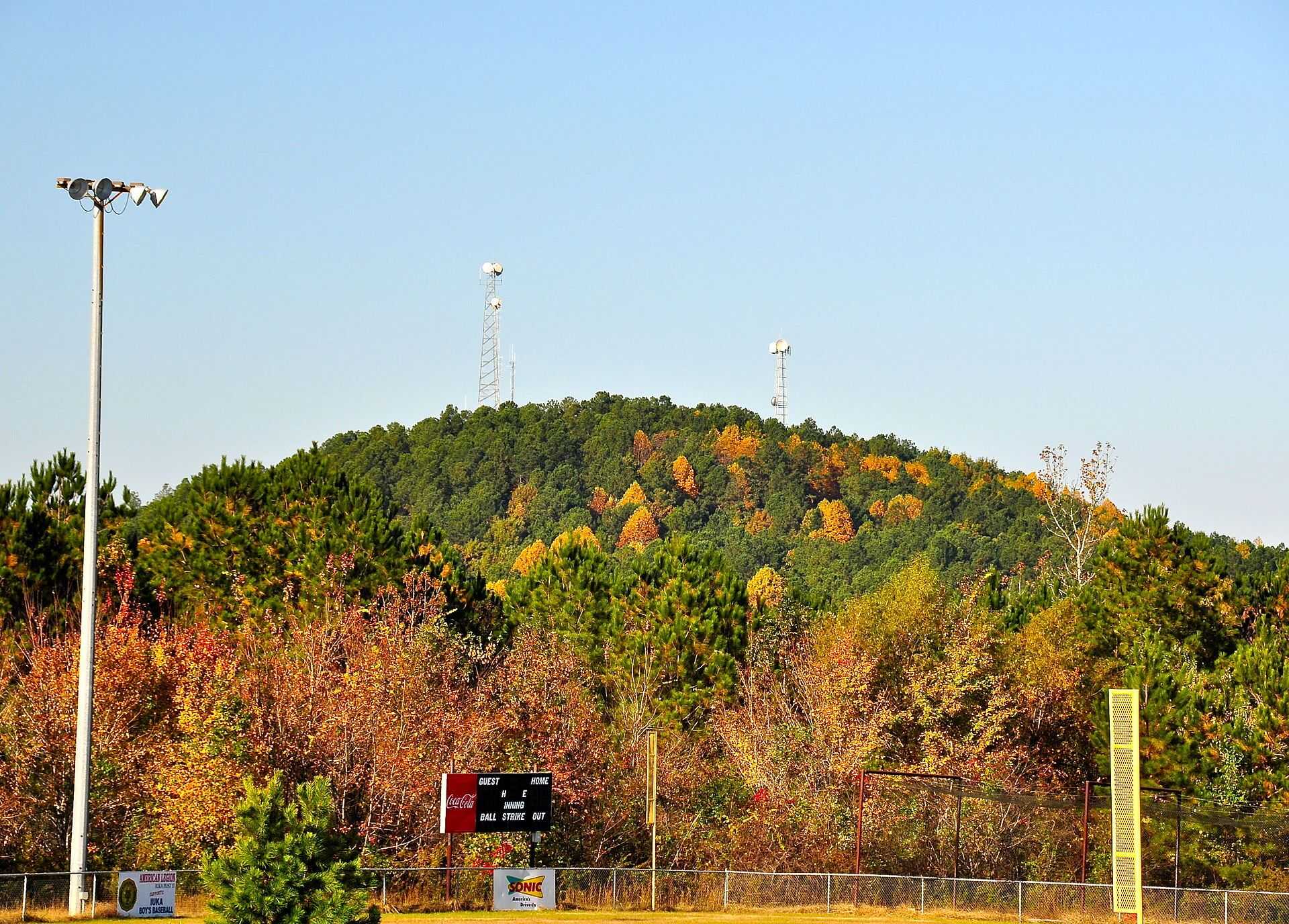
Woodall Mountain
Mississippi

Last Updated 31 Jan 2026
Woodall Mountain, located in the far eastern reaches of Mississippi, is a modest elevation that withstood the test of time against erosion. Its claim to fame is that it's the highest point in Mississippi, earning it a special place in the hearts of visitors. The mountain was initially named Yow Hill but was renamed in 1878 to honor Zephaniah Woodall, the sheriff of Tishomingo County at the time.
Woodall Mountain was the historic site of the Civil War's Battle of Iuka on 19 September 1862. The battle was fierce:
"The Union troops crested a hill, they paused, finding themselves above a densely wooded ravine crawling with Confederate forces. The ensuing combat saw relentless assaults up the hill, including the capture of a six-gun Ohio battery by the Confederates. The Union forces counterattacked from the ridge, and the intense battle raged on until darkness fell."
While it remains uncertain if this hill was Woodall Mountain, the area between the mountain's eastern and western summits does feature a brushy ravine, suggesting a possible connection. This site stands out as the most battle-scarred highpoint in the U.S. By the end of the conflict, approximately 4,500 Union soldiers had successfully driven about 3,200 Confederate troops from Iuka to Corinth, MS. The two armies clashed again in October 1862, with the Union securing victory.
Access Point
Navigate to QQQ5+48 Iuka, Mississippi
From the intersection of US-72 & SR-25 south of Iuka, exit onto SR-25 going south. Drive 0.1 mile and turn right onto CR-187 (Fairground Rd). Follow CR-187 for 1.2 miles, then turn right onto CR-176. After 0.7 miles on CR-176, turn right onto a well-maintained dirt road next to a residence and follow this steep road for 1.0 miles to reach the summit.
Recommended Route
The summit is visible from the road.
If you’re afraid of getting lost, follow The Loop Trail.
Regulations
The South Side offers a public easement to the summit, which may sometimes be gated. If the gate is closed, you can hike the 1.0 mile with an elevation gain of about 200 feet to the top.
The North Ridge trail passes through land owned by the Tombigbee Hunting Club. Although surrounded by private property, "No Trespassing" signs suggest that access along the road/trail is legal.
Lodging & Camping
Camping is possible in a tent or car at the summit, but it's unclear whether this is permitted.
FAQs
Can I bring my dog on the hike?
Keep your dog on a leash and ensure it doesn't disturb the natural habitat or other hikers. Be prepared to clean up after your pet.
Is there a fee to hike Woodall Mountain?
There is no fee to hike Woodall Mountain. It's open to the public.
What is the best time of year to visit Woodall Mountain?
You can visit Woodall Mountain year-round, but the best time is spring and fall when the weather is mild and the natural scenery is most vibrant. Summer hikes are also popular, though it can be hot.
Are there any facilities available at Woodall Mountain?
There are no facilities like restrooms or water fountains at Woodall Mountain. Visitors should plan to bring their water and pack out trash.
