Taum Sauk
Missouri

Last Updated 31 Jan 2026
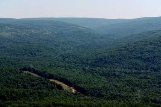
Taum Sauk Mountain is the highest point in the St. Francis Mountains, Iron County, and Missouri. While it is not the most prominent point in the state—that honor goes to the shorter Mudlick Mountain to the south—Taum Sauk Mountain offers a unique and accessible hiking experience. Located in Taum Sauk Mountain State Park, the mountain is a walk-up summit that is ADA-accessible. It ranks as the 41st highest state highpoint in the United States and is home to Missouri's tallest waterfall, Mina Sauk Falls, which drops 132 feet in three distinct stages. The park is particularly stunning in the spring when the waterfall is at its peak flow and in the fall when the foliage displays brilliant colors of yellow, red, and green.
Taum Sauk Mountain and the surrounding area have a rich history tied to the ancient St. Francis Mountains, a range believed to be one of the oldest exposed landforms in North America. The region is steeped in natural beauty and cultural significance, with a diverse ecosystem and a history of native peoples who once inhabited the area. The park is a testament to the conservation efforts to preserve Missouri's natural heritage and provide recreational opportunities for visitors.
Access Point
Navigate to H7FC+3Q Ironton, Missouri.
From Arcadia:
- Head south on State Route 21 for approximately 4.5 miles.
- Turn right onto Highway CC, following signs for Taum Sauk Mountain State Park. Along Highway CC, you will see an Adopt-A-Highway sign recognizing the Highpointers Club and its founder, Jack Longacre, who lived there.
- Continue on Highway CC until the pavement ends near a fork in the road. Take the left fork for a lookout tower with stunning views, or take the right fork to enter Taum Sauk Mountain State Park.
- Inside the park, you will find a viewing platform on the right side of the road with a panoramic photo labeling the peaks and valleys. At the end of the road, there is ample parking.
Recommended Route
Follow Taum Sauk Trail.
The trailhead sign indicates that the Mina Sauk Falls Trail is a three-mile loop. This trail is highly recommended, especially in the spring or fall. Mina Sauk Falls, the highest waterfall in Missouri, features a total drop of 132 feet over three distinct stages. The trail offers beautiful views and a moderately challenging hike through varied terrain.
Regulations
No fees or permits are required to hike to the summit of Taum Sauk Mountain. However, if you plan to camp in the park campground, there is a fee. Follow Leave No Trace principles and respect the natural environment to help preserve the area's beauty.
Lodging & Camping
Camping is available in Taum Sauk Mountain State Park for a fee at the designated campground. Additionally, free camping is allowed in the Mark Twain National Forest, which lies below and beyond Mina Sauk Falls. The park's campground provides basic amenities, while the national forest offers more primitive sites.
FAQs
What is the best time of year to visit Taum Sauk Mountain?
The best times to visit Taum Sauk Mountain are spring and fall. Spring offers the best water flow at Mina Sauk Falls, and fall showcases stunning foliage with vibrant colors.
Do I need a permit to hike Taum Sauk Mountain?
No, permits are not required to hike to the summit of Taum Sauk Mountain. However, there is a fee for camping in the park's campground.
Is the trail to Mina Sauk Falls difficult?
The Mina Sauk Falls Trail is a moderately challenging three-mile loop. It features varied terrain, including rocky sections and some elevation changes.
Are there restroom facilities at Taum Sauk Mountain State Park?
Yes, there are restrooms available at the park.
Is there a fee for parking at Taum Sauk Mountain State Park?
No, there is no fee for parking at the park.
Is Taum Sauk Mountain suitable for children and older adults?
Yes, the hike to the summit is ADA-accessible, and the trails are suitable for visitors of all ages and fitness levels.
