Mount Arvon
Michigan

Last Updated 31 Jan 2026
Mount Arvon may not be the most imposing peak, but it's Michigan's highest point. Located in the Huron Mountain Range in the north-central Upper Peninsula (U.P.), the mountain rises over 1,300 feet from the shores of Lake Superior, approximately 10 miles to the north. Despite its modest elevation, Mount Arvon offers a scenic and enjoyable hiking experience.
Mount Arvon was only recognized as Michigan's highest point in 1982 when a USGS survey determined its elevation to be 1,979.238 feet, just 11 inches higher than the previously identified high point, Mount Curwood, at 1,978 feet. This minor difference has led to some disputes, and some maps still incorrectly label Curwood as the highest. Historically, reaching Mount Arvon was challenging due to its remote location and maze of logging roads, but recent improvements have made the journey more accessible. The area around Mount Arvon is rich in natural beauty and reflects the rugged, unspoiled character of Michigan's Upper Peninsula.
Access Point
Navigate to QR4W+C5, Michigamme Township, MI 49962.
To reach Mount Arvon:
- From the intersection of US Hwy 41 and Broad Street just south of L'Anse, head north on Broad Street into L'Anse for 0.7 miles to Main Street.
- Turn right (east) on Main Street, which becomes Skanee Road, and continue for 16.1 miles to Roland Lake Road on the right (Zion Lutheran Church is on the southeast corner).
- Turn right (south) on Roland Lake Road and proceed 2.9 miles to Ravine River Road at Roland Lake.
The roads to the summit area are remote and rugged, but blue signs mark the route:
- At 0.7 miles, continue straight at the fork.
- At 1.8 miles, pass through a gravel pit.
- At 2.0 miles, leave the gravel pit and continue straight at the fork.
- At 3.0 miles, bear left at the fork.
- At 3.4 miles, bear right at the fork.
- At 4.0 miles, 4.5 miles, and 4.7 miles, continue straight at the forks.
- At 6.1 miles, turn right (south) at the T-intersection.
- At 6.3 miles, go left at the fork.
- At 6.4 miles, bear right at the fork.
- At 6.8 miles, bear right at the fork.
- At 7.2 miles, park in the lot and walk approximately a half mile to the summit.
Recommended Route
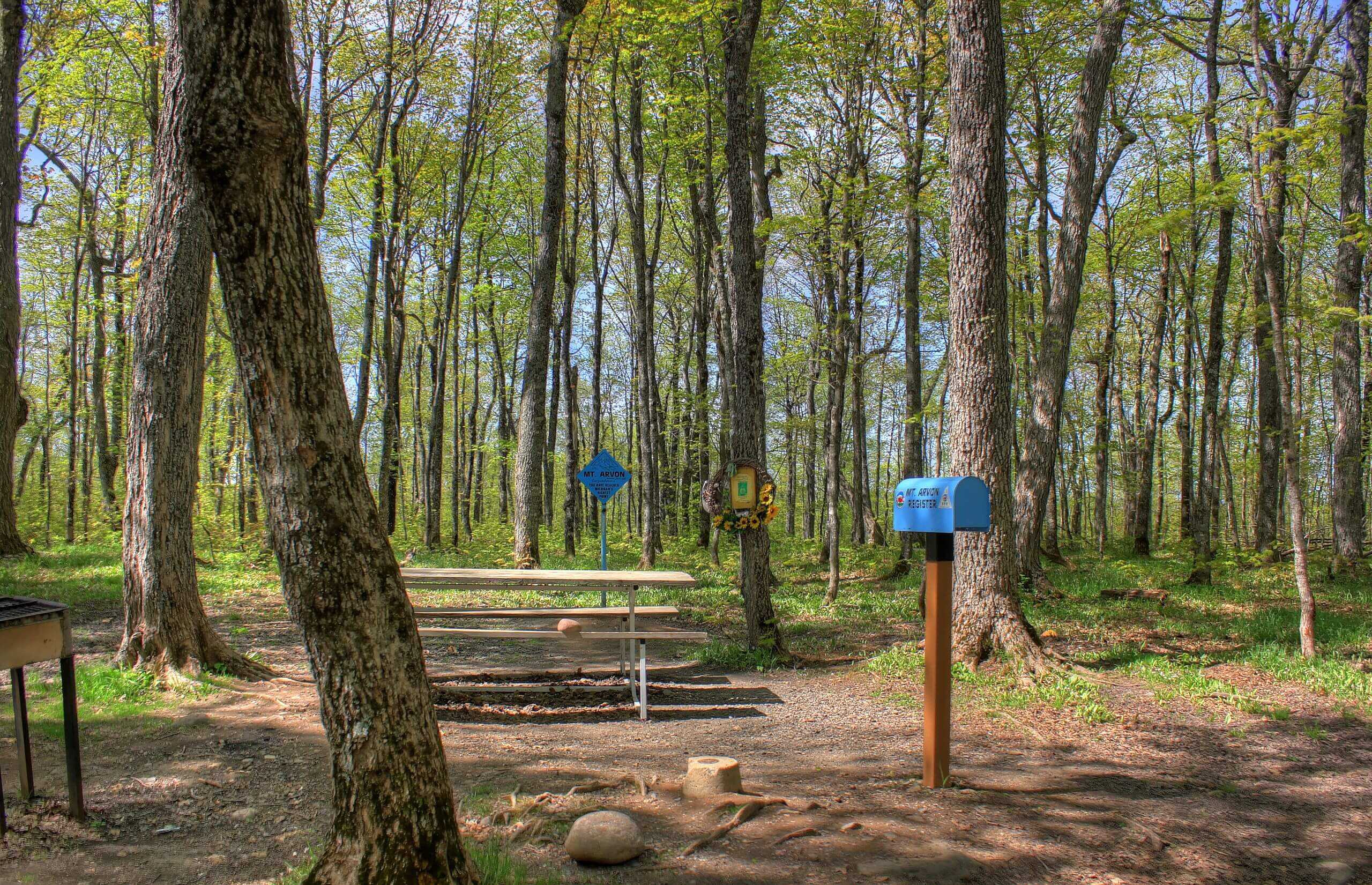
A level trail winds a half-mile from the parking area to the summit. This trail was once a rough road accessible by 4-wheel drive vehicles. The hike includes a few moderately steep sections but is generally accessible. A large blue sign and two blue benches denote the summit. Be sure to sign the logbook inside the steel mailbox on the summit marker.
If you prefer a longer route, consider The Mount Arvon Trail.
Regulations
Visiting Mount Arvon and using the access road is free of charge. Paper companies own the surrounding land and keep it undeveloped. Visitors are encouraged to respect the natural environment and stay on designated paths.
Lodging & Camping
Numerous campfire rings are near the road leading to the summit, but specific camping regulations are not well-documented. For more formal camping options, consider nearby Baraga State Park or other campgrounds in the Upper Peninsula, which offer a range of facilities.
FAQs
What is the best time of year to visit Mount Arvon?
The best time to visit Mount Arvon is from late spring to early fall when the weather is mild and the roads are clear. Winter can bring snow and ice, making access more challenging.
Do I need a permit to hike Mount Arvon?
No, a permit is not required to hike Mount Arvon. The summit and access road are free to visit.
Can I drive to the summit of Mount Arvon?
The road to the summit is well-graded but can be steep and rocky in sections. It is accessible by most vehicles, but check road conditions at the Baraga County Tourist Information building before setting out.
Are there restroom facilities at Mount Arvon?
There are no restrooms at Mount Arvon.
Is camping allowed at Mount Arvon?
While specific camping regulations are not well-documented, there are numerous campfire rings near the road leading to the summit. Baraga State Park offers facilities and outdoor activities for more formal camping.
What should I bring when hiking Mount Arvon?
Make sure to download an offline map of the area since the roads are remote and disorienting.
Is Mount Arvon suitable for children and older adults?
Yes, the trail to Mount Arvon is relatively easy and suitable for hikers of all ages, including children and older adults.
