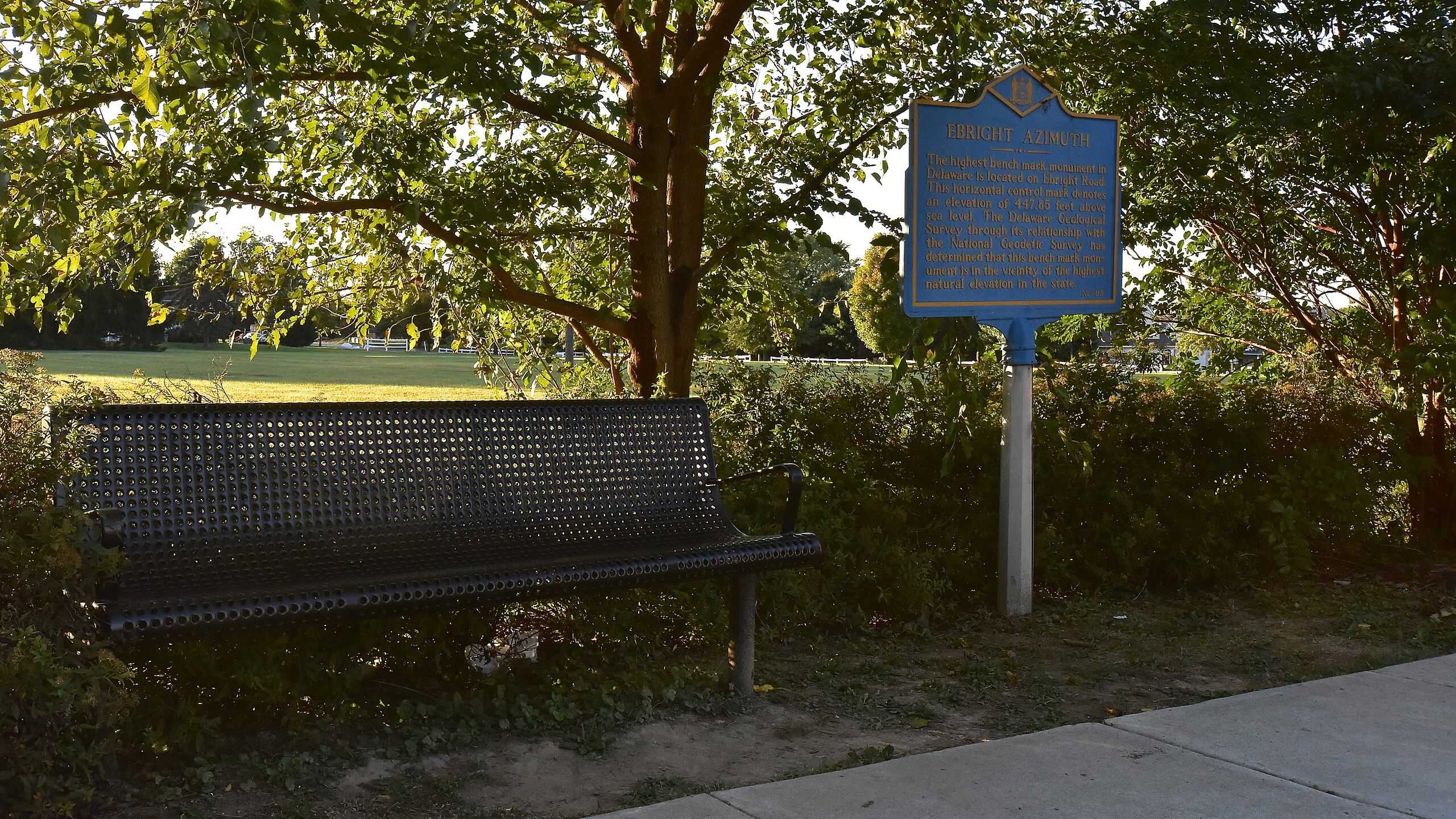
Ebright Azimuth
Delaware

Last Updated 8 Jul 2024
Ebright Azimuth is the official name of Delaware's state highpoint. Although it might not be a traditional peak and isn't a primary destination for peak baggers, it holds significance as one of the 50 State Highpoints. Ebright Azimuth stands at an elevation of 448 feet, making it the second-lowest state highpoint in the United States, just about 100 feet higher than Florida's Britton Hill.
Ebright Azimuth sits along Ebright Road, approximately 500 feet from the Delaware-Pennsylvania border. It is a virtual drive-up highpoint, making it convenient for visitors. Three USGS Benchmark disks are in the vicinity, but only one, situated in a dirt cutout from a sidewalk along Ebright Road, is recommended for visits. The other two benchmarks are on private property, and both the Highpointers Club and the State of Delaware advise against visiting these due to privacy concerns of local property owners.
Access Point
Navigate to RFPJ+78 Azimuth, Delaware.
From Wilmington, drive north on I-95 and take Exit 8 for Highway 202 Northbound. After 4.9 miles, turn right onto SR-92 East / Naamans Road. After 1.1 miles, turn left onto Ebright Road and continue for 0.6 miles to the intersection with Ramblewood Drive.
Recommended Route
After you park, walk along the sidewalk to Ebright Azimuth.
The highpoint marker and USGS Benchmark disk can be seen from the road.
Regulations
If you are approaching Ebright Azimuth via I-95, you'll pay tolls. Free parking is available along Ebright Road or Ramblewood Drive, but please park legally and respectfully in the residential area.
Lodging & Camping
Since Ebright Azimuth is a quick drive-up destination, there are no specific lodging or camping facilities directly at the highpoint. However, nearby Wilmington offers various accommodation options, including hotels and motels. Lums Pond State Park, located approximately 30 miles south of Ebright Azimuth, provides camping facilities and various outdoor activities for those looking to camp.
FAQs
What is the best time of year to visit Ebright Azimuth?
Ebright Azimuth can be visited year-round, as it is easily accessible and not subject to seasonal weather conditions that affect higher elevations.
Is there any hiking involved to reach the highpoint?
No, Ebright Azimuth is a drive-up highpoint. The marker and USGS Benchmark disk are visible from the road, making it an easy stop for visitors.
Are there any fees or permits required to visit Ebright Azimuth?
There are no fees or permits required to visit Ebright Azimuth. However, if you drive on I-95 during your approach, expect to pay tolls.
Can I visit the other USGS Benchmark disks near Ebright Azimuth?
Only visit the USGS Benchmark disk in the dirt cutout from the sidewalk along Ebright Road. The other two benchmarks are on private property, so please do not disturb the owners.
Is there parking available near Ebright Azimuth?
Yes, you can park legally along Ebright Road or Ramblewood Drive.
Are there any nearby attractions to visit after seeing Ebright Azimuth?
Nearby Wilmington offers hotels and various attractions, including museums, parks, and historical sites. Lums Pond State Park, about 30 miles south, provides outdoor activities and camping facilities.
What should I bring when visiting Ebright Azimuth?
Since Ebright Azimuth is a quick stop, you don't need any special equipment.
